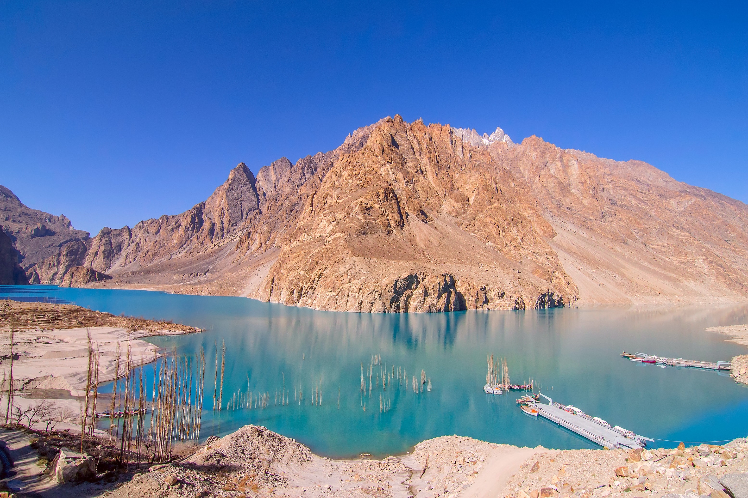
Flash floods triggered by torrential rainfall caused widespread destruction across several valleys in Pakistan's Diamer district overnight on July 13, 2026 [1, 2].
The disaster disrupts one of the region's most critical transit arteries and threatens the livelihoods of rural communities dependent on agriculture. Because the Karakoram Highway serves as a primary link for trade and transport in Gilgit-Baltistan, the blockage isolates the area and complicates emergency response efforts.
Heavy rains led to the sudden surge of water that swept through the valleys [1, 2]. The flooding resulted in significant damage to residential homes, farmland, and public infrastructure [1, 2]. Local reports said that the intensity of the rainfall overwhelmed natural drainage and riverbanks, leading to the devastation of crops and livestock areas [1, 2].
Beyond the immediate loss of property, the floods have severed transportation links. The Karakoram Highway remains blocked, preventing the movement of goods and people through the district [2]. This blockage creates a critical bottleneck for the region, as the highway is the main road connecting the mountainous northern territories to the rest of the country.
Emergency efforts are focused on assessing the total extent of the damage to public infrastructure [1]. Authorities said they are working to clear the debris from the highway to restore connectivity and allow aid to reach the affected valleys [2]. The scale of the destruction to farmland suggests a long-term impact on food security for the local residents of Diamer [1, 2].
“Flash floods caused widespread destruction to homes, farmland, roads, and public infrastructure”
The blockage of the Karakoram Highway combined with the destruction of farmland creates a dual crisis of logistics and subsistence. In Gilgit-Baltistan, where geography limits alternative routes, such infrastructure failure can lead to acute shortages of essential supplies and prolonged economic instability for agrarian communities.

'%2F%3E%0A%20%20%20%20%3Crect%20width%3D'1600'%20height%3D'900'%20fill%3D'url(%23v)'%2F%3E%0A%20%20%20%20%3Cg%20opacity%3D'0.08'%20fill%3D'%23ffffff'%3E%0A%20%20%20%20%20%20%3Ccircle%20cx%3D'1420'%20cy%3D'180'%20r%3D'220'%2F%3E%0A%20%20%20%20%20%20%3Ccircle%20cx%3D'1500'%20cy%3D'760'%20r%3D'120'%2F%3E%0A%20%20%20%20%3C%2Fg%3E%0A%20%20%20%20%3Cline%20x1%3D'80'%20y1%3D'172'%20x2%3D'220'%20y2%3D'172'%20stroke%3D'%23ffffff'%20stroke-width%3D'3'%20stroke-opacity%3D'0.6'%2F%3E%0A%20%20%20%20%3Ctext%20x%3D'80'%20y%3D'140'%20font-family%3D'Inter%2C%20-apple-system%2C%20Helvetica%2C%20sans-serif'%20font-weight%3D'700'%20font-size%3D'28'%20fill%3D'%23ffffff'%20letter-spacing%3D'6'%3EHANNA%20%C2%B7%20NEWS%3C%2Ftext%3E%0A%20%20%20%20%3Ctext%20x%3D'80'%20y%3D'230'%20font-family%3D'Inter%2C%20-apple-system%2C%20Helvetica%2C%20sans-serif'%20font-weight%3D'600'%20font-size%3D'40'%20fill%3D'%23ffffffb3'%20letter-spacing%3D'4'%3EWORLD%3C%2Ftext%3E%0A%20%20%20%20%3Ctext%20x%3D'80'%20y%3D'694'%20font-family%3D'Playfair%20Display%2C%20Georgia%2C%20serif'%20font-weight%3D'800'%20font-size%3D'110'%20fill%3D'%23ffffff'%20letter-spacing%3D'-1'%3EBangkok%20Pub%20Fire%20Kills%20at%3C%2Ftext%3E%3Ctext%20x%3D'80'%20y%3D'820'%20font-family%3D'Playfair%20Display%2C%20Georgia%2C%20serif'%20font-weight%3D'800'%20font-size%3D'110'%20fill%3D'%23ffffff'%20letter-spacing%3D'-1'%3ELeast%2027%20People%3C%2Ftext%3E%0A%20%20%20%20%3Ctext%20x%3D'80'%20y%3D'870'%20font-family%3D'Inter%2C%20-apple-system%2C%20Helvetica%2C%20sans-serif'%20font-weight%3D'500'%20font-size%3D'22'%20fill%3D'%23ffffff66'%20letter-spacing%3D'2'%3Enews.hanna-ai.com%3C%2Ftext%3E%0A%20%20%3C%2Fsvg%3E)