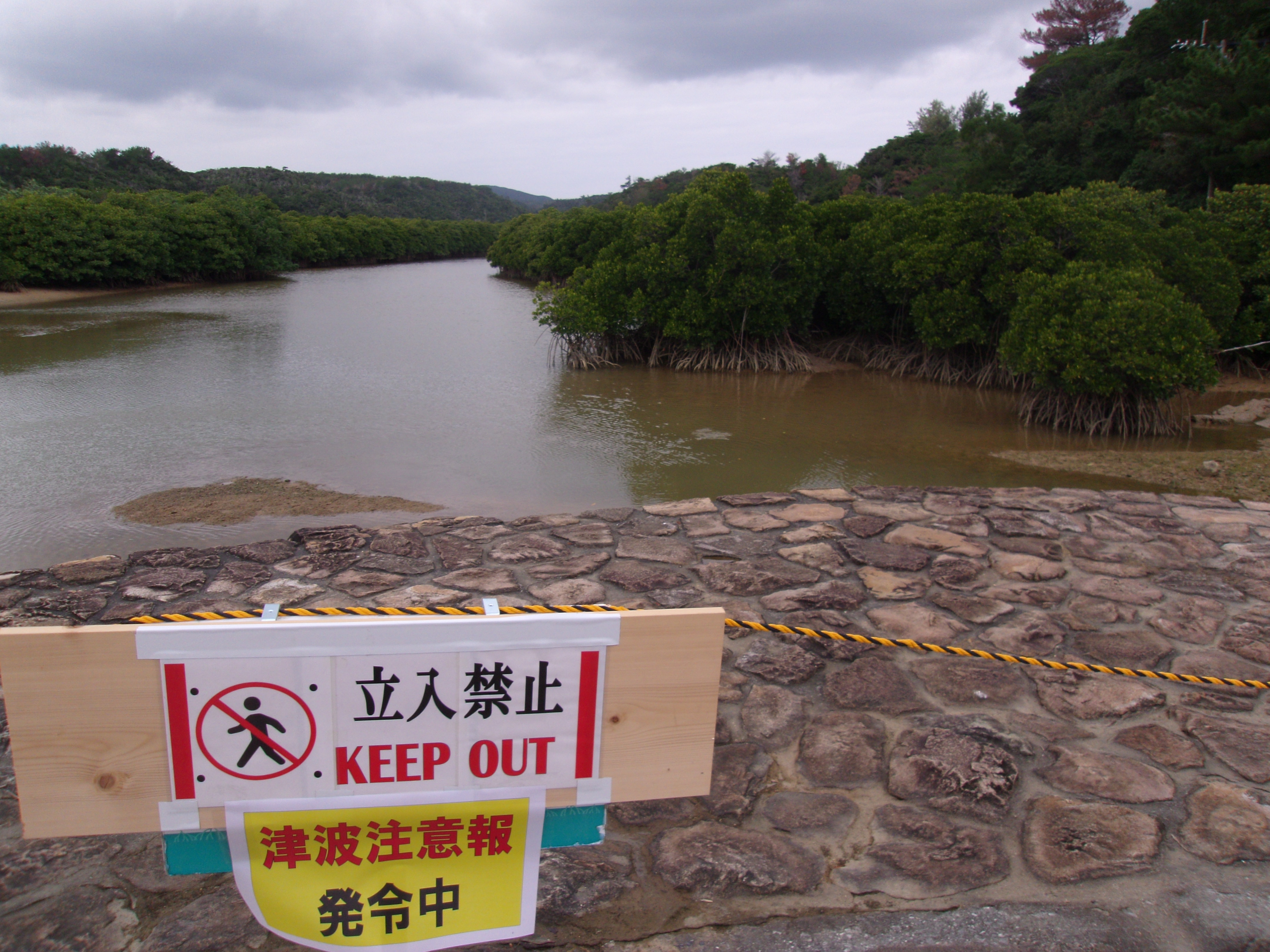
The Japan Meteorological Agency issued a tsunami advisory for the Okinawa main-island region and the Miyako and Yaeyama islands on June 3, 2024 [1].
This alert highlights the vulnerability of Japan's southern Ryukyu archipelago to seismic activity originating outside its own borders. Because the region consists of numerous small islands, even moderate tsunami waves can cause significant coastal flooding and disrupt maritime operations.
The advisory followed a magnitude 7.7 earthquake that struck the Philippines [2]. Officials said the quake could generate a tsunami affecting Japan’s Pacific coast, prompting the agency to monitor wave heights closely [2].
At approximately 10:40 a.m. JST on June 3, 2024, the agency updated the status of the alerts [1]. The JMA forecasted a maximum wave height of about one meter [1] for the affected areas.
Reports regarding the status of the advisory for the Miyakojima and Yaeyama islands varied across sources. One report indicated the advisory remained in place with the one-meter forecast [1], while another stated the advisory for those specific islands had been lifted [2].
The earthquake occurred on the night of June 2, leading to the subsequent alerts issued the following morning [1], [2]. Local authorities in the southern islands remained on alert as they tracked the movement of the displaced water across the Pacific.
“The JMA forecasted a maximum wave height of about one meter.”
This event underscores the interconnected nature of the Pacific 'Ring of Fire,' where a massive earthquake in the Philippines can trigger immediate maritime threats in Japan. The discrepancy in reporting regarding the lifting of the advisory for the Miyako and Yaeyama islands illustrates the challenges of real-time communication during evolving natural disasters, where warnings are frequently updated as wave data becomes available.