
Hawaii's Kilauea volcano erupted, producing lava fountains and ash plumes on the island of Hawai‘i [1].
The activity places the region on high alert as the U.S. Geological Survey (USGS) monitors the volcano's stability and forecasts further activity. Because the eruption involves significant ash and lava, it poses risks to local air quality and infrastructure.
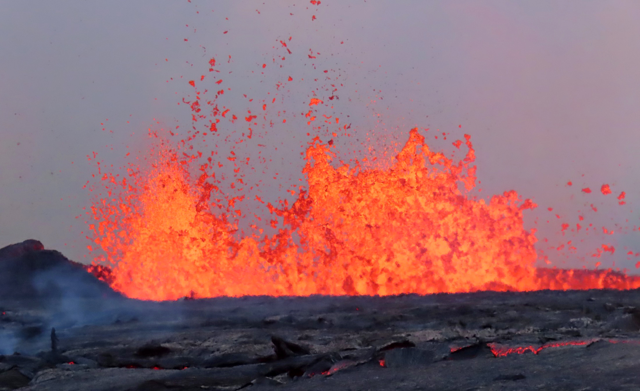
The USGS issued a Volcanic Activity Notice at 10:54 a.m. HST on Tuesday [6]. Monitoring agencies said lava fountains rose to approximately 1,000 feet [4]. These fountains are part of a larger pattern of ongoing volcanic activity that the USGS continues to track [2].
Atmospheric reports vary regarding the height of the eruption's ash plume. Some reports indicate the plume reached 30,000 feet [1, 2], while other reports place the height at 25,000 feet [3]. The USGS forecast additional lava fountains to occur around June 1 [5].
Geologists are utilizing real-time monitoring to assess the movement of magma beneath the surface. The eruption is characterized by the rapid ascent of molten rock, which creates the towering fountains and subsequent ash clouds. This process can lead to sudden changes in the landscape of the Big Island.
While some reports mentioned a magnitude-6.0 earthquake in the region [7], other primary monitoring sources did not confirm this specific seismic event. The USGS remains the primary authority for issuing warnings and guidance to the public as the eruption continues.
“Lava fountains rose to about 1,000 feet”
The eruption of Kilauea demonstrates the volatile nature of Hawaii's hotspot volcanism. The discrepancy in ash plume height and the unconfirmed reports of a major earthquake highlight the challenges of real-time data synchronization during a geological event. Continued monitoring by the USGS is critical to mitigate risks to aviation and local residents.


