The Korea Meteorological Administration issued heavy rain warnings for Jeju Island and the Namhae coast, and a typhoon warning for offshore waters east of Namhae [1].
These disparate weather patterns create simultaneous risks for the country, ranging from flash flooding in southern coastal regions to extreme heat stress in the capital city.
The heavy rain warnings follow a period of precipitation that began on Sunday. Some areas have already recorded cumulative rainfall of around 200 mm [1]. Current rainfall intensity is measured between 20 and 30 mm per hour [1], and officials forecast up to 80 mm of additional rain [1].
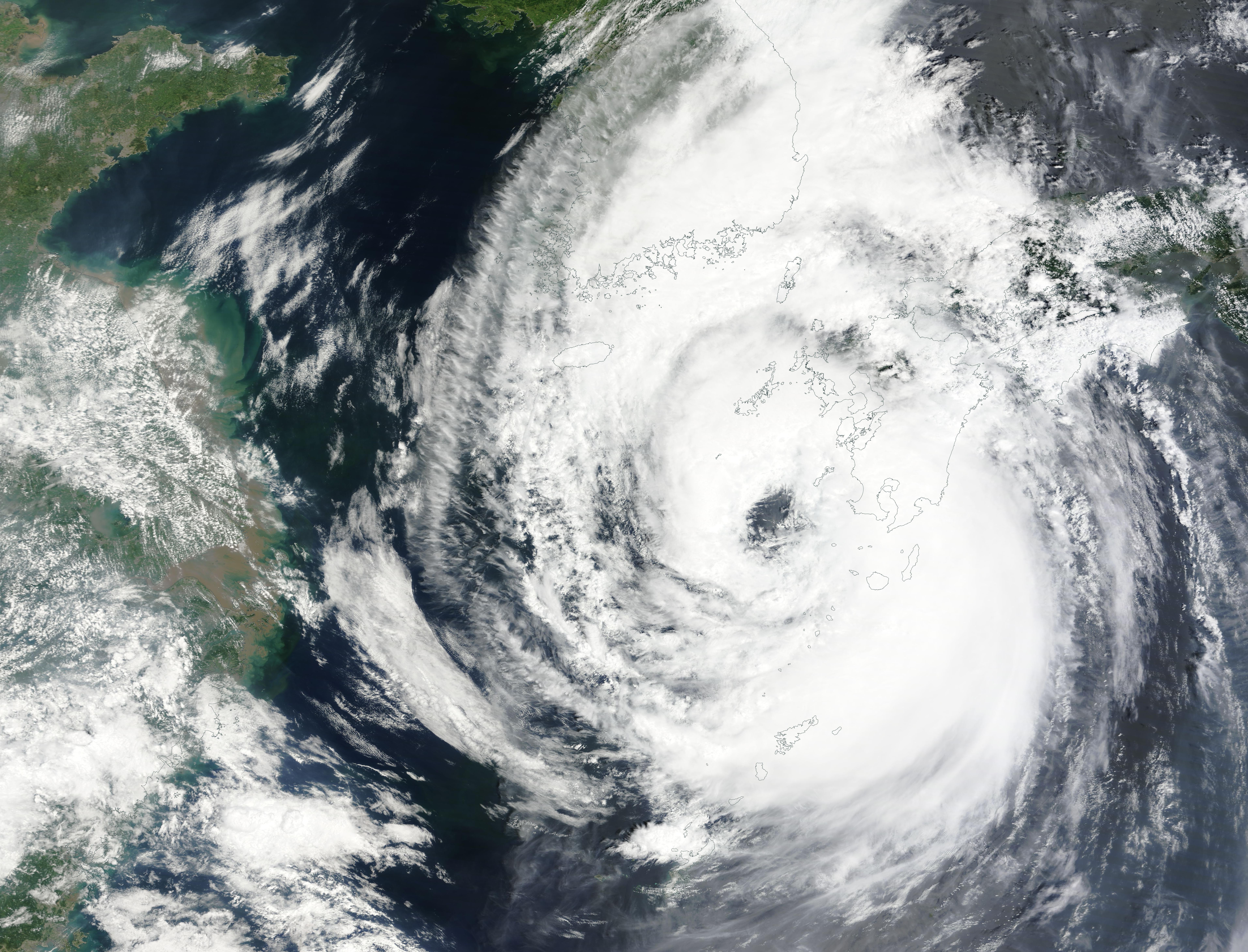
Weather officials said the conditions are driven by Typhoon Jangmi. Although the storm is moving toward Japan, its moisture is being drawn into the Korean peninsula [2]. The storm is noted as the third fastest to affect Korea in historical records [1].
While the south faces flooding, the central-west region is experiencing a heat wave. In Seoul, the morning temperature started at 17.7 °C [4]. However, the afternoon high is expected to reach 33 °C [5].
A YTN weather official said this is expected to be the hottest day of the year so far for Seoul. The temperature is seven degrees higher than the seasonal average [4].
The typhoon warning for the far sea east of Namhae marks the first such warning issued this year [6]. Local authorities are monitoring the moisture inflow to determine if the heavy rain will shift toward the central regions as the system evolves.
“The storm is noted as the third fastest to affect Korea in historical records.”
The simultaneous occurrence of a typhoon-driven rain event in the south and an extreme heat spike in the north demonstrates the volatile atmospheric conditions during the early June transition. The fact that Typhoon Jangmi is influencing weather patterns without making a direct landfall highlights how peripheral storm systems can still trigger significant infrastructure risks and public health concerns across the peninsula.